Chilly, cloudy, soggy, dreary. That's a pretty apt summary of the week here in Central New York. Sure, we had some steady rain and wind on Monday and Monday night, but overall the weather has just been...blah. We didn't get anywhere near the amount of rain from Sandy that I thought was possible, and this was a good thing. We had plenty of rain last week and some more over the weekend, so a few more inches on top of that would not have been good. But the heaviest rain was on the western side of Sandy, and Sandy tracked to our west. Then Sandy tracked to the north, and to then the northeast. Her associated upper-level low pressure center, though - the fingerprint of the storm higher in the atmosphere - remained stuck over us. As a result, we've had a series of chilly, cloudy, showery days since Sandy departed. It's been the Week of Sandy here in Freeville.
This week has been my first chance to compare my rain gauge measurements with my crude observations of the creek's rise and fall. Before, I was relying on rainfall measurements from the Ithaca airport, several miles away. While my rain gauge isn't representative of the whole basin contributing to the runoff into the creek, its should be more indicative than the airport measurements were. This post is a quick look at what I found this week.
Monday afternoon. We only received 0.05" of rain Sunday into Monday morning, and the heavier rains didn't approach the area until later Monday afternoon and through the evening hours. Before Sandy's infuence arrived, though, the creek was already higher than normal, and only a few inches below the dock.
Tuesday morning. I measured 0.35" of rain, but I wonder if more fell in upstream areas, because Fall Creek had swollen to within an inch or two of the base of the dock. The stream was moving quickly, but I didn't fear for the dock's safety. The water was calmer near the dock than in the middle of the stream. The heaviest rain had fallen and the dock was in good shape.
Tuesday late afternoon/early evening. More rain fell during the day, other rain that had fallen had time to accumulate in the creek, and by dinnertime the water was up to the base of the dock. Still, though, the dock was holding strong and the rate of rise was low, so I wasn't concerned.
Halloween morning. I measured 0.24" of rain that had fallen between Tuesday morning and Wednesday morning. The water was still up to the base of the dock - holding steady but not threatening to rise much higher.
Thursday morning. Though it was still raining - as you can see by the ripples on the water - the water level of the creek was going down as the water coming into the watershed from rainfall wasn't keeping up with the water leaving the watershed along the creek. I measured a total of 0.20" of rain from Wednesday morning to Thursday morning.
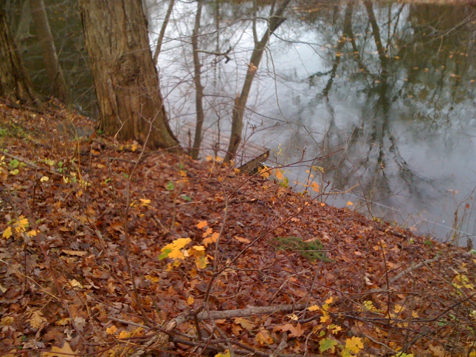
Friday morning. The creek is, if anything, higher than Thursday morning. The water level is still within 2-3 inches of the base of the dock. We're expected to finally see a break in the shower activity starting on Sunday, and so the creek should start going down over the next few days. I recorded 0.15" of rainfall from Thursday morning to Friday morning. The small waves that you can see on the creek's surface are from a quartet of mallards that I scared off upon my approach to the creek.
Here's a series of photos looking at the progression of the swollen creek over the course of the week:

A look upstream on Monday afternoon. Though we hadn't gotten much rain yet, the creek was already swollen.
Tuesday morning.
Tuesday late afternoon/early evening
Halloween
Thursday morning
Friday morning
And finally, here's a map from our local Weather Service office with rainfall estimates of precipitation from radar. As you can probably tell, radar can't come close to the accuracy of rain gauge measurements, though it is slowly improving. The heaviest rains fell in the Eastern Shore of Maryland, with much of Maryland, Delaware, and southern New Jersey receiving an estimated 5"+. It's pretty easy to follow the track of Sandy across central Pennsylvania and western New York - just follow the higher precipitation totals (except for the Cleveland area). The small black dot toward the upper center of the map shows the approximate location of Freeville.


 A look upstream on Monday afternoon. Though we hadn't gotten much rain yet, the creek was already swollen.


No comments:
Post a Comment