A blog about a first-time house owner learning to maintain his backyard, and thoughts about nature, science, history, and life.

Thursday, November 29, 2012

Freeville Tour: Groton Avenue Park


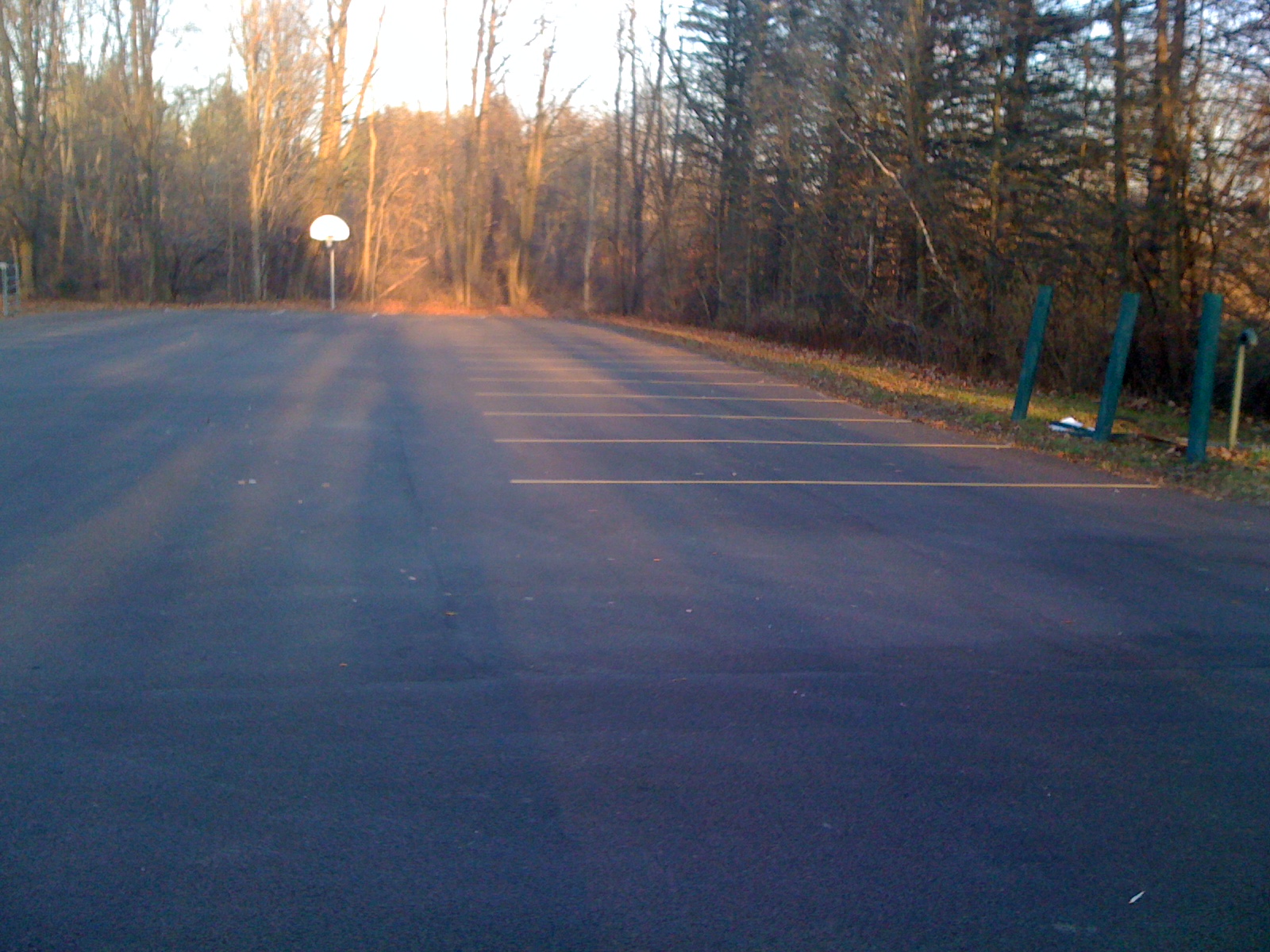
Today, we continue our tour of Freeville with a look at Freeville's other park, Groton Avenue Park.  This would probably be the "flagship" of the two parks in the Freeville park system, since it's a bit bigger, and even features a parking lot. I'd be a little nervous playing basketball on that court, though; I'm a terrible shot, and I'd probably airmail one over the backboard and into the creek beyond.


This picture is looks out from the parking lot to the three softball fields that form the bulk of the park.  The three brown splotches that you can probably make out beyond the first field are the three deer that I see all the time in my yard...which sits, as the deer roam, maybe a quarter mile from the park.  This photo is clear evidence that I need a real camera...using the iPhone with the zoom feature just doesn't cut it.


Next to the parking lot is the "kiddie area" of the park, including swings, a couple of spring-loaded ridey things, a seesaw, and an old school jungle gym.  There are also a couple of grills and a pavilion with picnic tables for parties.  Beyond the trees lies Fall Creek.


Here's a look at Fall Creek from behind the basketball hoop, looking upstream, toward the north.  The park side of the creek has a steeper bank that the far side, maybe six to eight feet, making it about half as big as the creek's bank when it winds around to my property. 


Here's a look directly across the creek.  It's amazing how flat the bank is on the other side, in comparison to the steep bank that you can't see on the near side (though you can tell that the photo was taken from several feet above the other side).  The other side of the creek, by the way, is a nature preserve, named after one of the old-time families of Freeville.


And here's a look downstream from roughly the same place.  Now the difference between the two banks is clearer.  The right side is relatively flat, while the left side has a steep incline of a few feet that is pretty consistent all the way around the bend.  The park forms a kind of peninsula as the creek takes a dramatic U turn...here, the creek is moving into the beginning of the U, and the big turnaround curve at the bottom of the U sits at the far end of the park.


A look from the parking lot past the playground equipment toward the softball diamond on the far side of the park.  The park, constrained by the creek, is well less than 100 yards wide...the creek makes quite the dramatic U turn! 


A view toward the opposite corner of the park, in which the two grills and other two softball fields are visible.


Now, I've walked along the same side of of the park towards the back, and this is looking diagonally across the other way.  In other words, I'm near the end of the first straightaway of the U.  You can see the houses of Groton Avenue in the distance. 


Here's a look in the upstream direction as the creek works its way down the U.  You can see that here, away from the curve and well into the straightaway, the bank is low on both sides; no steep bank here!


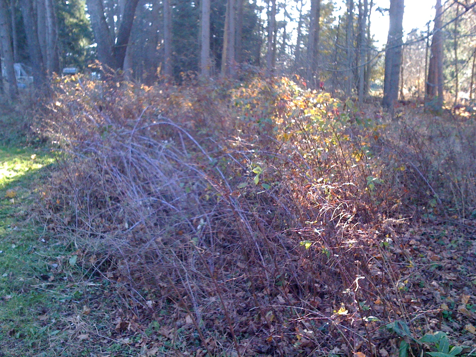
And here's a look in the downstream direction.  You can see the creek turning into the bend of the U.  I should note that to get to this point, I had to take a narrow trail through some relatively thick (and sometimes prickly) brush that's located at the far end of the park.


And here's some of that brush.  You can see a green thorny plant with its reddish thorns in the foreground.  I wonder if this area has ever been cleared or managed, besides cutting a couple of small trails through it.


Here's a tree that has literally doubled over.  At some point, it split in half, with the top half dangling ever since.  No idea why, though.


Here's a look across the top of the park.  I made my trip in the late afternoon over the weekend, and you can see the sun setting in the background.  The brush on the right is quite thick, but not thick enough to prevent the deer from seeking shelter in it during one of my earlier trips to the park when I startled them.


There are a couple of birdhouses in the park; not sure if they're occupied or not.


And here you can see, pretty dramatically, the vines that are trying to suffocate a couple of trees.  I suspect this may be the culprit for the doubled-over tree that I showed a couple of pictures ago. 


Here I've fought through a narrow trail at the other end of the bottom of the U, as the creek is coming out of the hairpin turn.  To me, it almost looked like a moonscape, so devoid of the trees and thick brush that had dominated the other side of the hairpin turn.  You can maybe make out the creek and the far bank in the background, which, owing to the curve, is much steeper than this side.


You should be able to make out a worn trail in the above photo...not sure if it's a human-made trail or a deer trail...probably used by both!  Also, that appears to be quite the fallen tree in the upper left corner.


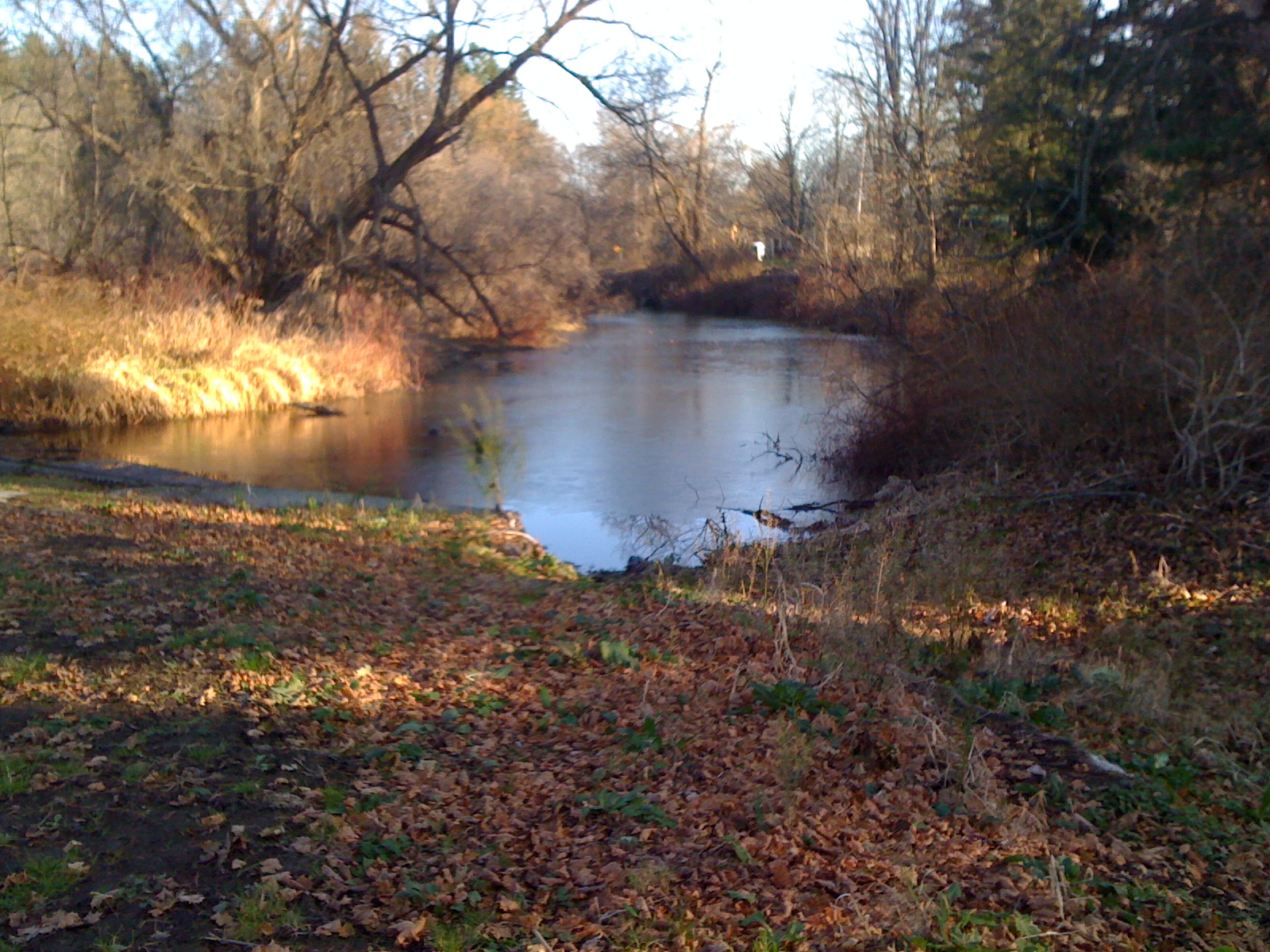
And now I've moved next to the creek, so you can see the water winding its way out of the U and into the second straightaway.  From here, it's nearly a straight shot to my dock!


And looking directly across the creek, you can see a random bench.  I'm guessing that there's a trail as part of the nature preserve over there.  Once we get a relatively warm weekend again, I'll have to check it out.


And here's a look downstream from about the same spot.  Somewhere down that way is the dock, and beyond it, my house.


And now I've fought back through the brush and looked back diagonally across the park.  The pavilion and playground equipment are off in the distance.


Either someone a little too heavy sat on the ends of the bench, or some local hooligans had some fun at some point.


While the softball diamonds are a little overgrown, and the basepaths consist of weeds and grass rather than dirt, (I don't know how regularly they're used), they come complete with a full complement of bases, including home plate.


Looking across the softball diamond, it's easy to imagine a burly lefty or a right-handed batter with a solid opposite-field stroke sending one off into the creek.  The park's really not that wide...but it's a great use of the land, and there's really an awful lot to see in a relatively small area.  Actually this is true of both of Freeville's parks.  Hope you've enjoyed this part of the tour!

Related post:

Freeville tour: Mill Dam Park

Wednesday, November 28, 2012

Color in the Yard


Even though just about all of the leaves have fallen off of the trees, there is still some color in the yard.  The leaves on the shrubs and thorny plants on the side of the yard have only recently changed color.  I wonder if they respond more slowly because they're closer to the ground, making them a bit less exposed to the elements than the branches of a tree.  In any event, they're providing a nice late fall splash of color to what has become an otherwise drab backyard.

As the wildflowers, shrubs, and other plants have begun to thin out throughout the fall, I have a better view into some of the more densely vegetated parts of the yard, and I'm discovering more pieces of eyesore and downed tree trunks that had heretofore been hidden.  It's amazing what perspective can do...the picture below is of the same patch of plants as the picture above.  Because the picture below looks in behind the plants and not against the grain, so to speak, you can see a piece of wood that was apparently just tossed in among the shrubs and thorny plants.  The plants don't seem to mind; they've just grown around it.


Tuesday, November 27, 2012

Last Bit of Leaves


Last Wednesday, I finally took the last six bags of leaves to the county recycling center.  As you can see, I'm not the only one.  My yard isn't completely devoid of leaves, though.  There are still some leaves scattered on the lawn, and there are plenty of fallen leaves under the trees and among the wildflowers.  They'll be left to decompose at their own pace and enrich the soil.  With winter rolling in, I don't see myself making another trip to the recycling center anytime soon, but once the weather turns warm again, I'll clear out some weeds from the garden and wildflower areas, and then have more bags to take. But for now, I don't mind staying warm inside the house.

Monday, November 26, 2012

Weekend Lake Effect Snow


In addition to our light snow on Saturday, we had some lake effect snow on Sunday.  Not sure if more snow actually fell or not, but on Sunday the snow stuck to the grass as well as the soil, so there definitely appeared to be more.  The lake effect clouds can be rather thin and still produce some snow.  Notice the sun peeking through in the photo below. 

I just saw a picture from the National Weather Service office in Binghamton showing that the lake effect machine has been in full effect farther to the north.  In the last 24 hours, parts of the Tug Hill plateau north of Syracuse have received up to 15" of snow!  We never get anywhere near that much lake effect around here...we're too far from Lake Ontario, and the Tug Hill enhances the snowfall due to its elevation.


Sunday, November 25, 2012

Cold Weekend


After a warm week, a cold front passed through Friday night, and the weekend has turned cold and windy.  When this happens in central New York in the winter, with a cold wind shifting around to the northwest, we tend to get lake effect snow showers.  This was the case on Saturday, as we had some light snow that stuck only on the colder surfaces.  Since Freeville is in the valley, we see a bit less snow that the surrounding hills during this type of event...and I really don't mind. 

Friday, November 23, 2012

Contrails


Not all clouds are purely natural.  We probably know this, but we rarely think of it.  And I'm not talking about cloud seeding and other deliberate attempts to manipulate clouds.  Airplanes leave behind a trail of exhaust gases, including water vapor.  The warmth of the airplanes' engines leaves the exhaust warmer than the surrounding air, and when it cools, it condenses into thin, narrow, linear clouds.  Over time, these clouds diffuse, as can be seen in the photo above. 

Though they seem to be fairly small, contrails have become an important part of the climate system, worthy of study by meteorologists and climate scientists.  In fact, a study was published a few years ago that chronicled the differences resulting from the few days following the September 11 attacks, when all North American air traffic was grounded and the atmosphere was contrail-free. 

Here in Freeville, we're largely out of the way of the major air routes, but planes do occasionally fly overhead, and contrails move into the area from upwind areas.  After all, I was able to take these two photos within a 15-minute span while I was outside last weekend.


Thursday, November 22, 2012

Turkey Day

A couple of quotes about turkeys for you on this Thanksgiving Day....
First, from a Facebook post by my employer, Cornell University:  Impress your Thanksgiving guests with these dinner table word origins from professor of linguistics, Wayne Harbert:
“Guinea fowl were the first birds called turkeys, at a time when they were mistakenly thought to come from Turkey. When turkeys were encountered in the new world, they were in turn confused with guinea fowl, and the name was transferred to them."
 And second, a quote from a letter by Benjamin Franklin to the Society of the Cincinnati, taken from Wikipedia:
"Others object to the Bald Eagle, as looking too much like a Dindon, or Turkey. For my own part I wish the Bald Eagle had not been chosen the Representative of our Country. He is a Bird of bad moral Character. He does not get his Living honestly. You may have seen him perched on some dead Tree near the River, where, too lazy to fish for himself, he watches the Labour of the Fishing Hawk[Osprey]; and when that diligent Bird has at length taken a Fish, and is bearing it to his Nest for the Support of his Mate and young Ones, the Bald Eagle pursues him and takes it from him.
With all this Injustice, he is never in good Case but like those among Men who live by Sharping & Robbing he is generally poor and often very lousy. Besides he is a rank Coward: The little King Bird not bigger than a Sparrow attacks him boldly and drives him out of the District. He is therefore by no means a proper Emblem for the brave and honest Cincinnati of America who have driven all the King birds from our Country...

I am on this account not displeased that the Figure is not known as a Bald Eagle, but looks more like a Turkey. For in Truth the Turkey is in Comparison a much more respectable Bird, and withal a true original Native of America... He is besides, though a little vain & silly, a Bird of Courage, and would not hesitate to attack a Grenadier of the British Guards who should presume to invade his Farm Yard with a red Coat on."
 Happy Thanksgiving!

Wednesday, November 21, 2012

Freeville Tour: Mill Dam Park


This post is the first in what will be a series of posts giving you a look at the Freeville area.  Freeville is built around its natural areas - namely, the two creeks, Virgil Creek and Fall Creek.  Both creeks meander aimlessly, zigging and zagging across the landscape with constant switchbacks.  The above photo was taken downstream of my dock, looking back upstream toward the dock.  A small island is visible in the left of the photo, as the creek splits and approaches the ruins of an old mill dam.


The above photo, taken from the same location as the previous one, but this one looking in the opposite, downstream, direction.  In the distance, Mill Dam Park and a concrete wall remaining from the old dam are visible in the background.


The sign for Mill Dam Park, one of two parks in Freeville that are maybe a half mile apart.  Fall Creek and the ruins of the old dam are hidden in the background, behind the trees.


Here's a look at the park.  It's got some wooded and some open space, picnic benches, a grill, and playground equipment.


A view of the park from another angle.


A view from the far side of the park looking back toward the near side.  In the distance are Fall Creek and the old dam.


To the left of the view in the above picture sits a small ravine or ditch with natural vegetation that provides a place for runoff to accumulate during times of high rainfall.


Beyond the ditch sits this retention pond, currently stagnant and overgrown with algae.  This photo was taken on a path connecting the main area of the park with the other areas of the park, farther from the road.  Under the path runs a culvert that allows excess runoff from the creek to enter the retention pond.


Above is a look from the same path as the previous photo, but looking in the opposite direction.  You can see the creek in the background, with a ditch forming a spillway between the creek and the path. 


The park has more open space here, farther from the road - room for the kids to run around, and benches for the parents or grandparents to sit on and watch.


Now we've moved over next to the creek.  This photo looks back towards the place where the first couple of photos in this post were taken.  On the far left bank of the creek is the small island that I pointed out earlier.  To the left, and out of view of the photo, are the remains of the old mill dam.


A look at some of the concrete remains of the old dam.


More dam remains.  The steel beam that crosses the creek connects to the small island on the other side.


A look at the other side of the dam.  In the background, you can see the other branch of the creek meeting up with the dammed branch that approaches from the right of the photo.  In the foreground and to the left, you can see a rusted spike and hook that were apparently used to connect across to the other side of the dam across the creek.


Looking downstream, the creek narrows and enters yet another zigzag in its winding course.


A reminder of Halloween, a pumpkin rests in peace up against a concrete slab of the dam.  It's somewhat surprising that more debris hasn't accumulated there.


Looking at a more shaded segment of the creek, patches of white - ice! - appeared on the surface.  This was surprising because I took these photos on Sunday afternoon, after the sun had been up for hours and temperatures had climbed well above freezing into the upper 40s.  I suppose this is a preview of winter - as temperatures plummet, it looks like the creek will freeze over.


Here's a view similar to the first photo in this post, looking back upstream toward my dock.  In the background, the water surface is shimmering with reflection, while in the foreground, the surface is still covered with patches of ice.


Looking to the left of the previous photo, the small island is visible on the opposite bank, while the creek is still covered with patches of ice in the shaded foreground.